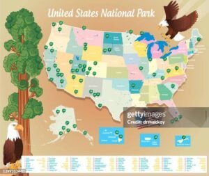
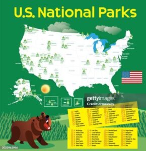
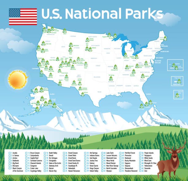
The United States has 63 national parks, each offering distinct landscapes, natural beauty, and recreational opportunities. From the rugged cliffs of the Grand Canyon to the remote wilderness of Alaska’s Denali, these parks offer an unparalleled way to experience America’s diverse natural heritage. With recent updates and additions, exploring National Park Map USA has never been more exciting, particularly with new resources and maps available in 2024.
Table of Contents
ToggleOverview of National Parks in the USA

Here is a complete look at the national parks across the U.S. by region, including notable highlights and tips for each park.
Western United States
- Yosemite National Park, California: Famous for its granite cliffs, waterfalls, and giant sequoias, Yosemite is one of the most iconic parks in the U.S. Explore popular spots like Half Dome, El Capitan, and Yosemite Valley. Visit during the spring for the best waterfall views or in the fall for vibrant foliage.
- Yellowstone National Park, Wyoming/Montana/Idaho: Known as the first national park in the world, Yellowstone is home to geothermal wonders like Old Faithful, the Grand Prismatic Spring, and abundant wildlife, including bison and bears. Summer is peak season, but winter offers a unique experience with snow-covered landscapes and frozen geysers.
- Zion National Park, Utah: A hiker’s paradise, Zion is famous for its red rock canyons, with highlights such as Angel’s Landing and The Narrows. Spring and fall provide ideal weather conditions for hiking.
- Grand Canyon National Park, Arizona: This park offers breathtaking views of the canyon, carved over millions of years by the Colorado River. It features numerous hiking trails, rafting opportunities, and scenic overlooks.
- Glacier National Park, Montana: Dubbed the “Crown of the Continent,” Glacier is renowned for its stunning mountains, lakes, and the Going-to-the-Sun Road. Visit between July and September to ensure all roads and trails are accessible.
- Death Valley National Park, California/Nevada: Known for being the hottest and driest place in North America, Death Valley features stunning salt flats, dunes, and panoramic views. Visit in winter for milder temperatures.
Eastern United States
- Great Smoky Mountains National Park, Tennessee/North Carolina: America’s most visited national park is known for its mist-covered mountains, diverse plant life, and scenic hikes. Fall is particularly picturesque, with vibrant foliage.
- Acadia National Park, Maine: This coastal gem offers rugged shorelines, Cadillac Mountain, and a mix of forests and lakes. Summer and fall are ideal times to visit, with summer offering coastal breezes and fall providing colorful landscapes.
- Everglades National Park, Florida: The largest subtropical wilderness in the U.S., the Everglades is home to alligators, manatees, and various bird species. The best time to visit is between November and April, when the weather is dry and pleasant.
Midwestern United States
- Badlands National Park, South Dakota: This park is known for its striking rock formations and fossils of ancient mammals. The park’s rugged beauty is best seen at sunrise or sunset.
- Indiana Dunes National Park, Indiana: Located on the southern shore of Lake Michigan, this park features sandy dunes, marshes, and forests, making it a perfect getaway for beach lovers and hikers alike.
- Cuyahoga Valley National Park, Ohio: Nestled between Cleveland and Akron, this park offers scenic trails, waterfalls, and historic sites like the Ohio and Erie Canal Towpath Trail.
Alaska’s Wilderness
- Denali National Park: Home to Denali, the tallest peak in North America, this park offers spectacular hiking, wildlife viewing, and glacier tours. The park is best visited in the summer for warmer weather and accessible trails.
- Glacier Bay National Park: Located in Southeast Alaska, it’s a paradise for kayakers and wildlife enthusiasts, with abundant marine life and glacial landscapes.
- Gates of the Arctic National Park: One of the most remote parks in the U.S., it’s known for its pristine wilderness and lack of roads or established trails.
National Park Map USA for 2024

In 2024, the U.S. National Park Service will offer updated National Park Map USA with detailed routes, trails, and amenities for all national parks. Here are some of the map types available:
Basic National Park Map: This map visually overviews all 63 national parks, highlighting their locations across the country.
State-Specific Maps: These maps show parks within individual states, which are useful for planning state-wide road trips or visits.
City-Proximity Maps: For those interested in which parks are nearest to major cities, these maps help identify parks that can be reached via short drives or flights.
Activity Maps: Some maps are tailored to specific activities like hiking, camping, or wildlife viewing, providing trails and campsites.
You can download the latest maps from the official National Park Service website or other reliable sources like the National Parks USA website.
The Evolution of the National Park System
The National Park System protects natural landscapes and plays a vital role in preserving cultural heritage. These sites represent America’s rich history, from the Ancestral Puebloan ruins in Mesa Verde, the Civil Rights landmarks in Selma, and the Montgomery National Historic Trail. The NPS has evolved to incorporate more diverse stories, acknowledging the importance of Indigenous, African American, and other historically significant narratives.
Future Developments in National Parks
Technology Integration: The National Park Service increasingly integrates technology to enhance visitor experiences. The NPS app provides interactive maps, real-time updates, trail guides, and educational content for park visitors.
Climate Change Adaptation: Parks adapt to changing climates by preserving water sources, implementing fire management strategies, and restoring habitats affected by drought, flooding, and invasive species.
New Parks: Discussions regarding creating new parks to protect critical habitats and historical sites, including potential additions in areas like New York and Texas, are ongoing.
Planning Your Visit to National Parks

Here are some essential tips to enhance your National Park Map USA visit experience:
Timing: Most parks are best visited during the shoulder seasons (spring and fall) to avoid crowds and enjoy mild weather. Some parks, like Death Valley, are better in winter, while parks like Glacier Bay are ideal in summer.
Reservations: Popular parks like Yosemite, Zion, and Yellowstone often require reservations for lodging, camping, and some hiking trails. Check the National Park Service website for details.
Park Fees: Most parks charge an entrance fee, but several “free days” exist throughout the year. In 2024, these include Martin Luther King Jr. Day, National Park Week, and Veterans Day.
Guided Tours: Many parks offer ranger-led programs, guided hikes, and wildlife tours to enrich your experience and provide deeper insights into the park’s natural and cultural history.
Sustainable Travel: Be mindful of the environment by adhering to Leave No Trace principles, staying on designated trails, and disposing of waste properly.
National Park Travel Tips for 2024
To have a memorable and safe trip, consider the following additional tips:
Advanced Reservations: Many popular parks, like Yosemite, Rocky Mountain, and Zion, have implemented reservation systems for certain trails or limited entry during peak seasons. Be sure to book early.
Wildlife Safety: Always maintain a safe distance from wildlife. Use binoculars for viewing and avoid feeding animals to prevent accidents and protect natural behaviors.
Sustainable Travel: Reduce your carbon footprint by using park shuttles, staying on designated trails, and minimizing waste. Many parks have recycling stations and composting toilets to encourage sustainable practices.
Weather Preparedness: Weather conditions can change rapidly, especially in mountainous and desert regions. Bring layers, rain gear, and adequate hydration for hikes.
Conclusion
With the latest maps and resources, exploring U.S. national parks in 2024 is more accessible than ever. Whether you’re a hiker, wildlife enthusiast, or simply seeking a serene escape, these parks offer unforgettable experiences and a deep connection to nature. Plan your adventure with updated maps and information for an enriching journey across America’s natural wonders.
FAQ
Where can I find maps for all U.S. national parks?
The National Park Service (NPS) offers a comprehensive collection of maps covering all 63 national parks. You can find and download these maps from the NPS website in various formats, including JPEG, PDF, and Adobe Illustrator. You can search for maps by park name, state, or category. The NPS app also offers an interactive map that works offline, making it convenient to navigate during your visit.
What does the National Park Map include?
The National Park Map USA provides essential details about the location of parks, visitor centers, campgrounds, trailheads, scenic drives, and specific attractions. Some maps highlight topographical information, hiking trails, backcountry routes, and water sources. Additionally, thematic maps, such as wildlife habitat areas and vegetation mapping, are available for deeper exploration.
How can I get a physical copy of the National Park Map?
Physical maps are available at most national park visitor centers. You can also request them directly from the NPS website. Many parks provide free maps upon entry, but larger, more detailed maps may be available for purchase at bookstores located within parks or through the NPS online store.
Are there any interactive or digital versions of the National Park Map?
The NPS has developed an interactive online map allowing users to zoom in on specific parks, view trail networks, and explore nearby facilities. The NPS app also features digital maps with GPS functionality, enabling real-time navigation without cellular service.
How often are the National Park Maps updated?
The NPS updates its maps regularly to reflect changes in trail conditions, park boundaries, visitor facilities, and access routes. Most maps receive at least one major update annually, often ahead of peak travel seasons, to ensure accuracy.
Can I use GIS data from the National Park Map for research or personal projects?
The NPS provides Geographic Information Systems (GIS) data for national parks. Researchers, educators, and enthusiasts can access GIS datasets that include terrain models, vegetation patterns, and land use details. This data is accessible through the NPS’s GIS website.

