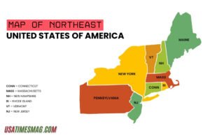
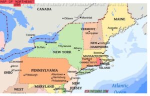
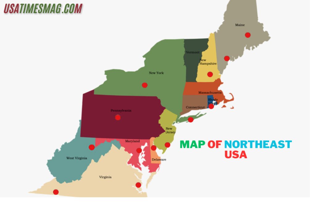
The Northeastern United States, often referred to as the Northeast, is a region rich in history, culture, and natural beauty. Comprising nine states—Maine, New Hampshire, Vermont, Massachusetts, Rhode Island, Connecticut, New York, New Jersey, and Pennsylvania—the Map of Northeast USA offers a diverse array of landscapes, from rugged coastlines to bustling urban centers. Understanding the geography of this region is essential for travelers, students, and anyone interested in the unique characteristics that define the northeastern corner of the United States.
Table of Contents
ToggleGeographical Overview

The Northeast is bordered by Canada to the north, the Atlantic Ocean to the east, the Southern United States to the south, and the Midwestern United States to the west. This strategic location has made it a historical gateway for immigration and trade, contributing to its rich cultural tapestry.
The region can be broadly divided into two subregions: New England and the Mid-Atlantic.
- New England: This subregion includes Maine, New Hampshire, Vermont, Massachusetts, Rhode Island, and Connecticut. Known for its picturesque towns, rolling hills, and significant historical sites, New England is often celebrated for its vibrant fall foliage and maritime heritage.
- Mid-Atlantic: Comprising New York, New Jersey, and Pennsylvania, the Mid-Atlantic is characterized by its bustling cities, such as New York City and Philadelphia, as well as its diverse landscapes that range from the Appalachian Mountains to coastal plains.
State-by-State Breakdown

- Maine: As the northeastern most state, Maine is renowned for its rugged coastline, maritime history, and abundant natural resources. The iconic Portland Head Light and Acadia National Park are major attractions.
- New Hampshire: Known for its expansive forests and the White Mountains, New Hampshire offers outdoor enthusiasts’ opportunities for hiking, skiing, and exploring quaint towns like Portsmouth.
- Vermont: Famous for its maple syrup and covered bridges, Vermont’s Green Mountains provide a scenic backdrop for activities like skiing in Stowe and visiting the charming town of Burlington.
- Massachusetts: Home to Boston, one of the nation’s oldest cities, Massachusetts boasts a rich colonial history, prestigious universities, and cultural landmarks such as the Freedom Trail.
- Rhode Island: The smallest state by area, Rhode Island features a stunning coastline with sandy shores and historic towns like Newport, known for its Gilded Age mansions.
- Connecticut: With a mix of coastal cities and rural areas, Connecticut offers attractions like Mystic Seaport and Yale University in New Haven.
- New York: Beyond the metropolis of New York City, the state includes natural wonders like the Adirondack Mountains and Niagara Falls.
- New Jersey: Known for its shoreline, New Jersey offers destinations like Atlantic City and the historic town of Princeton.
- Pennsylvania: Rich in American history, Pennsylvania is home to Philadelphia’s Liberty Bell and Gettysburg National Military Park.
Major Cities and Urban Centers

The Map of Northeast USA is home to several major cities that serve as cultural and economic hubs:
- New York City, New York: As the largest city in the United States, NYC is a global center for finance, arts, and culture. Landmarks include Times Square, Central Park, and the Statue of Liberty.
- Boston, Massachusetts: Known for its significant role in American history, Boston offers attractions like the Freedom Trail, Fenway Park, and numerous museums.
- Philadelphia, Pennsylvania: The birthplace of American independence, Philadelphia features historic sites such as Independence Hall and the Philadelphia Museum of Art.
- Providence, Rhode Island: As the capital city, Providence boasts a vibrant arts scene and historic architecture.
- Hartford, Connecticut: Known as the “Insurance Capital of the World,” Hartford also offers cultural sites like the Mark Twain House.
Transportation and Accessibility
The Northeast’s dense network of highways, railways, and airports makes it one of the most accessible regions in the country.
- Highways: Interstate 95 runs along the East Coast, connecting major cities from Maine to Florida. Other significant highways include I-90, I-80, and I-84.
- Railways: Amtrak’s Northeast Corridor provides high-speed rail service between Boston and Washington, D.C., with stops in major cities.
- Airports: Major international airports include John F. Kennedy International Airport (JFK) in New York, Logan International Airport (BOS) in Boston, and Philadelphia International Airport (PHL).
Cultural and Natural Attractions
The Map of Northeast USA offers a plethora of attractions that cater to diverse interests:
- Historical Sites: Explore colonial history in Williamsburg, Virginia, or visit the battlefields of Gettysburg in Pennsylvania.
- Natural Parks: Acadia National Park in Maine and the Adirondack Park in New York provide opportunities for hiking, camping, and wildlife observation.
- Cultural Institutions: Museums like the Metropolitan Museum of Art in NYC and the Museum of Fine Arts in Boston showcase world-class collections.
Climate and Best Time to Visit
The Northeast experiences four distinct seasons:
- Spring (March to May): Mild temperatures and blooming flora make it an ideal time for outdoor activities.
- Summer (June to August): Warm weather is perfect for coastal visits and festivals.
- Fall (September to November): Renowned for its vibrant foliage, fall is a peak season for tourism.
- Winter (December to February): Cold temperatures and snowfall offer opportunities for winter sports.
Conclusion
The Map of Northeast USA reveals a region steeped in history, cultural diversity, and natural beauty. From the bustling streets of New York City to the serene landscapes of Vermont, the Northeast offers a rich tapestry of experiences for residents and visitors alike. Whether you’re planning a trip, studying American history, or simply exploring the diverse landscapes of the United States, the Map of Northeast USA offers a wealth of experiences waiting to be discovered.
FAQs about Map of Northeast USA
Which states are included in the Northeast region of the United States?
The U.S. Census Bureau defines the Northeast region as comprising nine states: Connecticut, Maine, Massachusetts, New Hampshire, New Jersey, New York, Pennsylvania, Rhode Island, and Vermont.
What are the major cities located in the Northeast USA?
Prominent cities in the Northeast include New York City, Philadelphia, Boston, Pittsburgh, Newark, and Providence. These urban centers are significant for their historical, cultural, and economic contributions to the region.
What are the key geographical features of the Northeast USA?
The Northeast boasts diverse geographical features, including the Appalachian Mountains, the Atlantic Ocean coastline, the Great Lakes, and major rivers such as the Hudson, Delaware, and Connecticut. The region also features the Adirondack and White Mountains, as well as the coastal plains.
Where can I find detailed maps of the Northeast USA?
Detailed maps of the Northeast USA are available through various sources:
- Mappr: Offers political maps highlighting state boundaries and major cities.
- Free World Maps: Provides both political and physical maps of the region.
- OnTheWorldMap.com: Features maps showing states, capitals, cities, and major roads.
What are the subregions within the Northeast USA?
The Northeast is commonly divided into two subregions:
- New England: Includes Maine, New Hampshire, Vermont, Massachusetts, Rhode Island, and Connecticut.
- Mid-Atlantic: Comprises New York, New Jersey, and Pennsylvania.
How does the Northeast USA compare in size and population to other U.S. regions?
The Northeast is the smallest U.S. region by area but is densely populated. As of the 2020 census, it had a population of approximately 57.6 million people, making it one of the most densely populated regions in the country.

