In an ever-connected world, the maps of the USA and Canada serve as more than just tools for navigation. These maps reflect the political boundaries, cultural intersections, and economic ties that bind over 360 million people across two of the world’s largest and most developed countries. This guide takes you through the latest updates and features of these Map of USA and Canada in 2024, explaining their significance in various aspects such as travel, education, and digital applications.
Table of Contents
ToggleGeographical Overview

United States of America
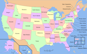
The United States comprises 50 states covering a vast swath of North America, with Alaska in the northwest and the Hawaiian archipelago in the mid-Pacific. The mainland is bordered by Canada to the north and Mexico to the south, with the mighty Atlantic Ocean to the east and the Pacific Ocean to the west.
Key geographic features include:
- The Rocky Mountain and the Appalachian Mountain are major ranges influencing climate and weather patterns.
- Major rivers include the Mississippi, one of the world’s longest rivers.
- Great Plains are known for their fertile soil, making the U.S. one of the world’s leading agricultural producers.
Canada
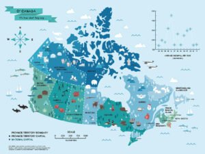
Canada is the second-largest country in the world by total area and comprises ten provinces and three territories. It extends from the Atlantic to the Pacific. As well as northward into the Arctic Ocean.
Significant geographical features include:
- The Canadian Rockies and the Coast Mountains, with numerous national parks and protected areas, attract millions of tourists annually.
- The Great Lakes, shared with the United States, contain at least 21% of the world’s fresh water.
- The Arctic Archipelago is particularly sensitive to the effects of climate change.
Political Boundaries and Border Dynamics
The USA and Canada have maintained a peaceful and cooperative relationship, with their border spanning approximately 8,891 kilometers (5,525 miles), not including Alaska. This border is largely unprotected and testament to the strong diplomatic and economic ties between the two countries.
Border Crossings and Agreements
Major border crossings like those at Niagara Falls, the Ambassador Bridge in Detroit, and the Peace Arch in Blaine are vital for trade and tourism, handling millions of crossings annually. The two countries cooperate on various fronts, including defense (under NORAD), environmental protection, and trade (underpinned by agreements like USMCA).
Economic and Environmental Cooperation
Trade Relationships
The U.S. and Canada are each other’s largest export markets. Essential goods such as automobiles, machinery, and agricultural products flow regularly across the border. Energy resources, particularly natural gas and oil from Canada, are crucial to the U.S. economy, while Canada benefits from U.S. investments in technology and manufacturing.
Environmental Initiatives
Both countries are part of international accords like the Paris Agreement and collaborate on cross-border environmental initiatives to manage shared resources responsibly. This includes conservation efforts in shared ecosystems like the Great Lakes and collaborative approaches to reducing air and water pollution.
Educational Use of Maps
School Curricula
Map of USA and Canada are integral to school curricula, facilitating the teaching of geography, history, and social studies. They help students understand geopolitical boundaries, economic regions, and cultural diversity. Interactive and digital maps provide dynamic, user-engaged learning experiences through virtual field trips and interactive quizzes.
Research and Development
Researchers utilize detailed Map of USA and Canada for various purposes, including environmental monitoring, urban planning, and the study of climatic changes. These Map of USA and Canada provide crucial data that support sustainable development goals and policy-making processes.
Maps in Travel and Tourism
Road Trips and Navigation
For travelers, road Map of USA and Canada are indispensable. They offer detailed views of highways, country roads, and the locations of rest stops, gas stations, and attractions. With the advent of smart mobility, maps integrated into vehicle navigation systems and smartphones provide real-time updates and route optimization.
Adventure and Exploration
Outdoor enthusiasts rely on specialized maps, such as topographic maps, for hiking, mountain biking, and skiing activities. These Map of USA and Canada offer detailed relief structures, elevations, and geographical landmarks, essential for safe and enjoyable adventures.
Technological Advances and Mapping Technologies
Modern mapping technologies and GIS are crucial for all from urban planning and disaster response to environmental monitoring and border security. Satellite imaging and GPS innovations have transformed how countries manage their geographical data and cooperate on transboundary issues.
Digital Mapping Trends
By 2024, digital mapping technologies have significantly advanced. Interactive maps integrating real-time data such as weather conditions, traffic updates, and demographic information are at the forefront of this evolution. Augmented reality (A.R.) maps that overlay digital information on the real world offer immersive ways to explore cities, hiking trails, and tourist attractions.
Satellite Imagery and Remote Sensing
Using satellite imagery and remote sensing has refined the accuracy of maps. These technologies help update maps with the changing landscapes due to natural events like earthquakes, floods, or human-made changes such as new infrastructures and urban sprawl.
Cultural Ties and Societal Impact
The cultural exchange between the USA and Canada is vibrant and dynamic. Shared languages (English and French), sports (hockey, baseball), and holidays (such as Thanksgiving, albeit on different dates) reflect deep-rooted social and cultural connections.
Future Directions

Sustainability and Conservation
Future mapping will likely focus more on sustainability and environmental conservation. Map of USA and Canada highlighting protected areas, biodiversity hotspots, and regions vulnerable to climate change can be crucial in conservation efforts and education.
Smart Cities
As urban areas expand, smart city initiatives increasingly rely on detailed Map of USA and Canada for infrastructure management, traffic planning, and emergency services. These maps facilitate the efficient use of resources and improve urban living conditions.
Conclusion
The Map of USA and Canada is a tapestry of rich histories, shared resources, and mutual interests. It symbolizes a unique partnership between two of the world’s most advanced nations, continuously evolving through diplomacy, trade, and cultural exchange. As of 2024, this relationship remains a cornerstone of North American stability and prosperity, helping to shape global political and economic dynamics.
This overview provides a glimpse into the complexities and intricacies of the map of the USA and Canada, reflecting their enduring alliance and the continuous interplay between their natural landscapes and human activities.
FAQs about Map of USA and Canada
What are the main features on a typical map of the USA and Canada?
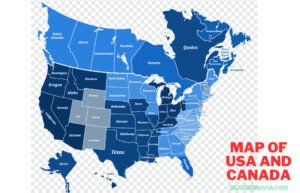
Maps of the USA and Canada typically display state and provincial boundaries, major cities, significant water bodies like the Great Lakes, and notable geographical features like the Rocky Mountains. These maps also often include road networks, especially major highways, and can be found in various forms, such as digital or printed versions.
How do I find a detailed map of a specific region within the USA or Canada?
For detailed regional maps, resources like MapChart and ontheworldmap.com provide tools to customize maps to show more localized details such as municipal boundaries, city locations, and even thematic elements like climate or population density.
Are there digital maps that offer real-time data for the USA and Canada?
Modern digital maps often incorporate real-time data, including traffic updates, weather conditions, and even live feeds of local events. These maps are available through various online platforms and apps, enhancing navigation and travel planning.
Can I download and print maps of the USA and Canada for personal use?
Maps available from websites like ontheworldmap.com can be downloaded and printable. They are usually free for personal and educational use, provided proper attribution is given when displayed publicly or used in publications.
What tools are available for customizing maps of the USA and Canada?
Online platforms like MapChart offer features to customize maps by changing colours, adding legends, and editing labels to suit various needs, whether for educational purposes, presentations, or personal interests.
How are digital maps updated for accuracy?
Digital maps are updated using a combination of satellite imagery, user-contributed data, and updates from governmental and other official sources. These updates ensure that changes due to construction, new roads, or altered boundaries are reflected accurately.


